
“Glacier” has been a part of my vocabulary since I was 6, while on my first trip to Glacier National Park with my family. I remember looking at the rocky mountains in wonder, disbelieving that there was any place in the world that could hold snow through the summer. I probably used to think all snowy mountain peaks had glaciers. I didn’t understand that glaciers form when hundreds or thousands of years of accumulated snow stays frozen throughout the year. I knew that they moved, and carved landscapes, depositing giant rocks (known as erratics) across the land. But to me, that just made them all the more mystical, as if the ice was breathing life into the mountains around it, and taking that life away just as easily.


Map showing the park entrance, Eielson Visitor Center, and the toe of the Muldrow Glacier to the southwest (outdated: Mount McKinley is now Denali). NPS photo
In Denali, 16% of Denali’s 6 million acres is covered in glaciers as of 2016. The Muldrow glacier is more than 30 miles long, making it one of the longest and most notable glaciers in the park. But the glacial landscape is changing drastically due to climate change. Glacier monitoring can tell researchers how much glaciers are receding or extending in the park. One way that park researchers have monitored the change is by using repeat photography, or accurately recreating historical photos in the present day to monitor the changing landscape.
Our goal: to reach the Muldrow Glacier by foot in a short weekend.
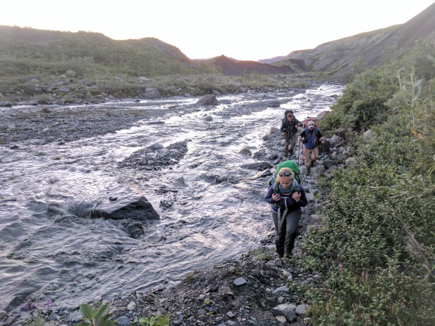
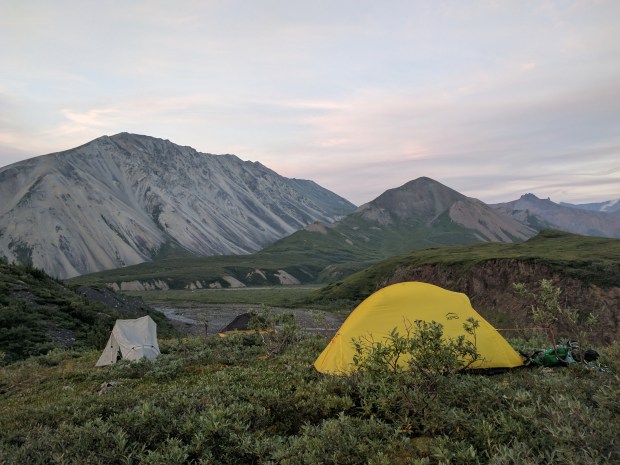
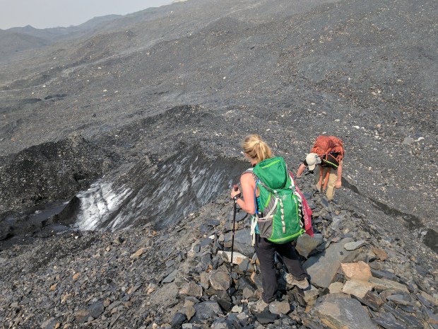
There were four of us on the 4pm camper bus last Friday, rumbling our way towards the Eielson Visitor Center (at mile 66 of the park road). We arrived at 8pm that evening. We filled our water bottles, tightened our boot laces, and set off down the mile-long trail to the Thorofare River. The next five hours consisted of river crossings, three miles of travel across the gravel river bar, and three miles hiking up Glacier Creek (pictured below). At 1:15am, still hiking by the light of the setting sun, we found a campsite that looked over the rocky toe of the glacier and Denali behind it. We set up our cooksite 100 yards down stream and started boiling water at 1:30pm. That’s not too late for dinner, right?


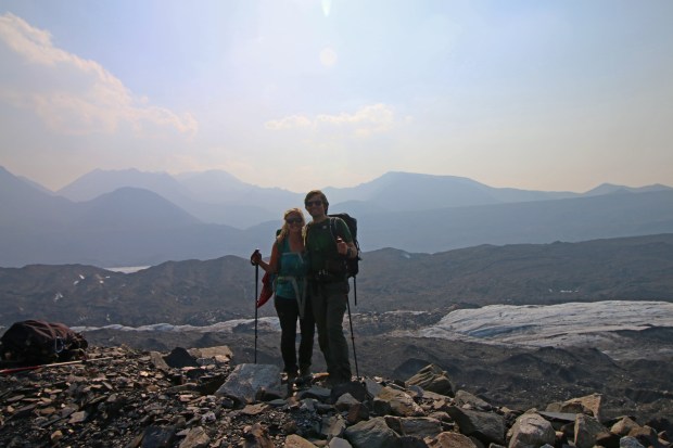
The next morning, we started up the small ridgeline parallel to Glacier Creek. The sun was out and the sky was clear, but the Alaska Range in the distance was hazy, mostly likely from changing winds that brought in smoke from a far-off wildfire.

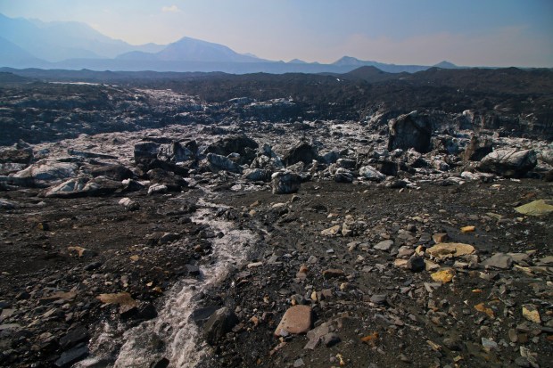
It was like walking on a moonscape. Distance was impossible to judge—without trees or shrubs of any kind, there was nothing to judge scale or size by. A hill of rocky scree could turn out to be a couple hundred feet tall, and over every rise we just found more rock beyond it.


Denali, North America’s tallest peak, with the Muldrow Glacier stretching out across the photo in the foreground.
Eventually, we saw them. What looked like small chunks of ice were lying haphazardly in the rock, acting as a natural barrier to the exposed ice field beyond. We dropped over 1200 feet in elevation to get a closer look.
I was reminded of the planet Matt Damon’s character was so desperate to escape in Interstellar, and I wasn’t far off–the scenes of Dr. Mann’s planet in the movie were filmed on the Svínafellsjökull glacier in Iceland!


A puddle we found on a glacial ridge turned out to be a crack in the ice formation. John was able to put his entire hiking pole and half his arm down, still without reaching the bottom.
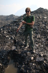
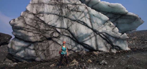
The glacial erratics stood nearly 30 feet tall, and we walked around them as we worked our way to the toe of the glacier. The sun beat down from above, and the air was warm. Sounds of melting ice and snow filled the glacial amphitheater around us. Water ran through the moraine in rivulets and dripped off of the boulders.
Rocks slid from under our feet, exposing glare ice just inches below the surface of many of the rises we climbed. Though it was hiding beneath a layer of ground-up debris, we were, in fact, hiking on top of the glacier.


By the time we made it back to the Eielson Visitor Center at 2pm on Sunday, we’d hiked just over 24 miles in less than 48 hours—my longest and most rewarding backpacking trip by far. It was also my favorite trip I’ve taken, and probably will be for a long time. But in all honesty, backpacking isn’t always the glamorous and adventurous photo shoot that it seems to be. Bushwhacking through shoulder-high willows, being hunted by mosquitoes, scorched by the sun, exhausted in the last few miles as I watched the visitor center creep closer and closer—these are all things that I look back on with appreciation, but at the time could be difficult and frustrating (I like to call those types of scenarios “Type 2” fun).
Don’t get me wrong, the adventure is worth it. But I don’t want to only portray the best and easiest parts of my outdoor experiences. I feel very lucky to be outfitted and prepared enough to go so deep into the Denali Wilderness, but I’ll expand more on the privileges of getting outdoors later.
Happy trails,
Lindsey

One thought on “Investigating Ice on the Muldrow Glacier”